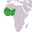
File:Africa-countries-WAFU-UFOA.png
Africa-countries-WAFU-UFOA.png (360 × 392 pixels, file size: 14 KB, MIME type: image/png)
Nhoroondo ye fayera
Dzvanya pa musi/nguva kuti uringe fayera sekuoneka kwaraita panguva iyoyo.
| Musi/Nguva | Mfananoudoko | Mitandu | Mushandisi | Komenda | |
|---|---|---|---|---|---|
| parizvino | 16:53, 27 Kurume 2016 |  | 360 × 392 (14 KB) | Christian Ferrer | Reverted to version as of 08:56, 26 March 2016 (UTC) |
| 15:36, 27 Kurume 2016 |  | 360 × 392 (12 KB) | Insidema | Reverted to version as of 16:33, 25 March 2016 (UTC) | |
| 08:56, 26 Kurume 2016 |  | 360 × 392 (14 KB) | Ankry | Reverted to version as of 18:48, 9 July 2011 (UTC) | |
| 16:33, 25 Kurume 2016 |  | 360 × 392 (12 KB) | Hpyounes | update | |
| 18:48, 9 Chikunguru 2011 |  | 360 × 392 (14 KB) | Maphobbyist | South Sudan has become independent on July 9, 2011. Sudan and South Sudan are shown with the new international border between them. | |
| 01:28, 4 Chikunguru 2011 |  | 360 × 392 (10 KB) | File Upload Bot (Magnus Manske) | {{BotMoveToCommons|de.wikipedia|year={{subst:CURRENTYEAR}}|month={{subst:CURRENTMONTHNAME}}|day={{subst:CURRENTDAY}}}} {{Information |Description={{de|Karte Mitgliedstaaten der de:West African Football Union}} |Source=Transferred from [http://de.wi |
Kushandiswa kwe fayera
The following page uses this file:
Kushandiswa kwe fayera pasirose
Mawiki anotevera ayo anoshandisa fayera iri:
- Hushandiso pa azb.wikipedia.org
- Hushandiso pa br.wikipedia.org
- Hushandiso pa ca.wikipedia.org
- Hushandiso pa de.wikipedia.org
- Hushandiso pa en.wikipedia.org
- Hushandiso pa es.wikipedia.org
- Hushandiso pa fi.wikipedia.org
- Hushandiso pa ha.wikipedia.org
- Hushandiso pa hi.wikipedia.org
- Hushandiso pa hu.wikipedia.org
- Hushandiso pa incubator.wikimedia.org
- Hushandiso pa kcg.wikipedia.org
- Hushandiso pa mdf.wikipedia.org
- Hushandiso pa no.wikipedia.org
- Hushandiso pa pt.wikipedia.org
- Hushandiso pa sd.wikipedia.org
- Hushandiso pa smn.wikipedia.org
- Hushandiso pa th.wikipedia.org
- Hushandiso pa uk.wikipedia.org
- Hushandiso pa www.wikidata.org

