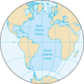
File:Atlantic Ocean - en.png
Atlantic_Ocean_-_en.png (328 × 328 pixels, file size: 12 KB, MIME type: image/png)
Nhoroondo ye fayera
Dzvanya pa musi/nguva kuti uringe fayera sekuoneka kwaraita panguva iyoyo.
| Musi/Nguva | Mfananoudoko | Mitandu | Mushandisi | Komenda | |
|---|---|---|---|---|---|
| parizvino | 16:44, 5 Kukadzi 2024 |  | 328 × 328 (12 KB) | Janitoalevic | . |
| 16:23, 31 Nyamavhuvhu 2015 |  | 328 × 328 (12 KB) | Wmq | Reverted to version as of 20:21, 22 August 2009 - wrong bot edit | |
| 12:24, 29 Nyamavhuvhu 2015 |  | 328 × 328 (12 KB) | SteinsplitterBot | Bot: Image rotated by 180° | |
| 20:21, 22 Nyamavhuvhu 2009 |  | 328 × 328 (12 KB) | Serg!o | {{original||2004 version}} == {{int:filedesc}} == {{Information |Description=North and South Atlantic Ocean |Source= [https://www.cia.gov/library/publications/the-world-factbook/geos/zh.html CIA World Factbook - Atlantic Ocean] ([https://www.cia.gov/l |
Kushandiswa kwe fayera
The following page uses this file:
Kushandiswa kwe fayera pasirose
Mawiki anotevera ayo anoshandisa fayera iri:
- Hushandiso pa ace.wikipedia.org
- Hushandiso pa am.wikipedia.org
- Hushandiso pa as.wikipedia.org
- Hushandiso pa az.wikipedia.org
- Hushandiso pa bcl.wikipedia.org
- Hushandiso pa bh.wikipedia.org
- Hushandiso pa blk.wikipedia.org
- Hushandiso pa bn.wikipedia.org
- Hushandiso pa ca.wikipedia.org
- Hushandiso pa cdo.wikipedia.org
- Hushandiso pa dty.wikipedia.org
- Hushandiso pa en.wikipedia.org
- Hushandiso pa en.wikibooks.org
- Hushandiso pa en.wikinews.org
- Hushandiso pa en.wikiquote.org
- Hushandiso pa en.wikisource.org
- Hushandiso pa en.wikiversity.org
- Hushandiso pa eo.wikipedia.org
- Hushandiso pa eo.wiktionary.org
- Hushandiso pa eu.wikipedia.org
- Hushandiso pa fi.wikipedia.org
- Hushandiso pa fi.wiktionary.org
- Hushandiso pa gu.wikipedia.org
- Hushandiso pa haw.wikipedia.org
- Hushandiso pa ht.wikipedia.org
- Hushandiso pa hy.wikipedia.org
- Hushandiso pa ilo.wikipedia.org
- Taaw Atlantiko
- Wikipedia:Napili nga artikulo ita nga aldaw/Abril 5
- Wikipedia:Napili nga artikulo ita nga aldaw/Mayo 20
- Wikipedia:Napili nga artikulo ita nga aldaw/Hulio 4
- Wikipedia:Napili nga artikulo ita nga aldaw/Agosto 18
- Wikipedia:Napili nga artikulo ita nga aldaw/Oktubre 2
- Wikipedia:Napili nga artikulo ita nga aldaw/Nobiembre 16
- Wikipedia:Napili nga artikulo ita nga aldaw/Disiembre 31
- Wikipedia:Napili nga artikulo ita nga aldaw/Pebrero 14
- Hushandiso pa incubator.wikimedia.org
- Hushandiso pa is.wikipedia.org
- Hushandiso pa kaa.wikipedia.org
- Hushandiso pa kcg.wikipedia.org
- Hushandiso pa ku.wikipedia.org
- Hushandiso pa la.wikipedia.org
Ringa kushandiswa kumwe kwe vupasirose kwe fayera rino.


