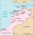
File:Map of Morocco from CIA World Factbook.png
Map_of_Morocco_from_CIA_World_Factbook.png (326 × 348 pixels, file size: 10 KB, MIME type: image/png)
Nhoroondo ye fayera
Dzvanya pa musi/nguva kuti uringe fayera sekuoneka kwaraita panguva iyoyo.
| Musi/Nguva | Mfananoudoko | Mitandu | Mushandisi | Komenda | |
|---|---|---|---|---|---|
| parizvino | 09:08, 15 Ndira 2018 |  | 326 × 348 (10 KB) | ديفيد عادل وهبة خليل 2 | Removed border by cropping 1 % horizontally and 1 % vertically using CropTool with precise mode. |
| 17:57, 16 Zvita 2016 |  | 329 × 352 (10 KB) | Ankry | Reverted to version as of 08:48, 26 March 2016: no consensus; create a separate map if you need (UTC) | |
| 18:35, 9 Zvita 2016 |  | 329 × 352 (25 KB) | Adharass | Reverted to version as of 20:54, 25 March 2016 (UTC) | |
| 08:48, 26 Kurume 2016 |  | 329 × 352 (10 KB) | Ankry | Reverted to version as of 15:22, 8 August 2008 (UTC) | |
| 20:54, 25 Kurume 2016 |  | 329 × 352 (25 KB) | Hpyounes | Western Sahara included | |
| 15:22, 8 Nyamavhuvhu 2008 |  | 329 × 352 (10 KB) | BetacommandBot | move approved by: User:Samulili This image was moved from Image:Mo-map.png {{en|Map of Morocco from CIA World Factbook}} {{fr|Carte du Maroc de la CIA World Factbook}} {{PD-USGov-CIA-WF}} Category:Maps of Morocco === File history === {| |
Kushandiswa kwe fayera
Kushandiswa kwe fayera pasirose
Mawiki anotevera ayo anoshandisa fayera iri:
- Hushandiso pa als.wikipedia.org
- Hushandiso pa bs.wikipedia.org
- Hushandiso pa ca.wikipedia.org
- Hushandiso pa csb.wikipedia.org
- Hushandiso pa cs.wikipedia.org
- Hushandiso pa cy.wikipedia.org
- Hushandiso pa da.wikipedia.org
- Hushandiso pa de.wikipedia.org
- Hushandiso pa de.wiktionary.org
- Hushandiso pa diq.wikipedia.org
- Hushandiso pa en.wikipedia.org
- Hushandiso pa en.wikinews.org
- Hushandiso pa eo.wikipedia.org
- Hushandiso pa es.wikipedia.org
- Hushandiso pa es.wikibooks.org
- Hushandiso pa eu.wikipedia.org
- Hushandiso pa fi.wikipedia.org
- Hushandiso pa fo.wikipedia.org
- Hushandiso pa fy.wikipedia.org
- Hushandiso pa he.wikipedia.org
- Hushandiso pa hr.wikipedia.org
- Hushandiso pa it.wikipedia.org
- Hushandiso pa it.wikinews.org
- Hushandiso pa jam.wikipedia.org
- Hushandiso pa ja.wikipedia.org
- Hushandiso pa kaa.wikipedia.org
- Hushandiso pa lfn.wikipedia.org
Ringa kushandiswa kumwe kwe vupasirose kwe fayera rino.

